The Chantal storm became the third named system of this year’s Atlantic hurricane season early Saturday and now has its sights set on the southeastern United States. While not expected to cause widespread destruction, the system has prompted a tropical storm warning and could significantly affect beach goers and coastal residents through the weekend.
Chantal Storm Develops Off the Coast of the Carolinas
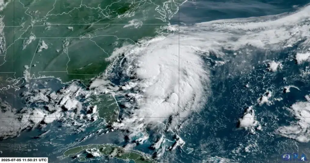
Forming just 150 miles south- southeast of Charleston, South Carolina, the Chantal storm marks the first Atlantic system of the season to directly impact the United States. Winds were sustained at 40 mph by Saturday morning, with slight intensification expected before the storm makes landfall Sunday morning in South Carolina.
A tropical storm warning is now in effect for parts of both the South Carolina and North Carolina coastlines, with meteorologists urging residents and tourists to stay alert.
What to Expect From the Chantal Storm
The Chantal storm is moving north at just 2 mph, meaning its impacts will be drawn out over the weekend. Forecasts suggest that between 2 and 4 inches of rainfall may drench areas of the Carolinas, with isolated totals up to 6 inches by Monday.
The tropical storm warning includes risk of:
- Heavy downpours and localized flooding
- Wind gusts near 50 mph
- Rough surf and dangerous rip currents
- Minor storm surge of 1 to 2 feet in areas experiencing onshore winds
Beach goers and boaters are strongly advised to follow all guidance related to the tropical storm warning, especially given that the Chantal storm could produce life-threatening rip currents along the Carolina coastline.
See Also : Iga Swiatek Dominates to Reach Wimbledon Finals.
Fourth of July Weekend Plans Impacted
The timing of the Chantal storm has complicated Fourth of July celebrations along the southeastern coast. While much of the country enjoys clear skies and warm temperatures, the Southeast faces a damp, unstable forecast through Sunday night.
Fortunately, conditions are expected to improve after Monday, with clearer skies returning by Tuesday across the region affected by the tropical storm warning.
Outside the Southeast, much of the Northeast and West will enjoy ideal July 4th weekend weather. However, areas of Texas and the Upper Midwest remain at risk for strong to severe thunderstorms, separate from the Chantal storm system.
A Broader Look at National Weather
While the Chantal storm generates headlines along the Atlantic coast, central Texas faces deadly flooding earlier this weekend from unrelated thunderstorms. Rising rivers and overflowing campgrounds led to tragic consequences as rainfall exceeded expectations.
Meanwhile, the tropical storm warning remains the top concern in the Southeast as officials continue monitoring the Chantal storm using satellite and radar imagery.
Though not a hurricane, the Chantal storm serves as an important reminder how tropical weather system, even moderate ones can disrupt daily life. The tropical storm warning remains active, and authorities recommend residents prepare for potential flooding, power outages, and dangerous beach conditions through the holiday weekend.
As the Chantal storm continues to inch toward land, meteorologists and emergency officials stress caution and preparedness. All eyres remain on the coastline as the tropical storm warning hold steady.


